Wellington City Cycle Map 2026 | Ko te Mahere Pahikara o te Tāone o Pōneke 2026

Search in document library
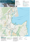
Wellington City Cycle Map 2026 | Ko te Mahere Pahikara o te Tāone o Pōneke 2026 preview
  • Published Date Fri 17 Jul 2026
All Tags
  • Document topic Cycling
  • Document category Map

Bike network of the Greater Wellington region - Ko ngā ara Pahikara o Pōneke Nui Tonu

Please Note: On this map a yellow shared path that connects at its north end to the red dashed Mount Victoria off-road commuter route, is an off road shared path. At the south end it connects with Ellice Street and the Wellington East Girls school grounds. It doesn’t connect to the Mt Victoria Tunnel yellow shared path as this map shows.

Updated 17 July 2026 at 10:41