-
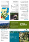
Hunting in the Hutt Water Collection Area
A handy pamphlet outlining tips, rules, and regulations
for hunting in the Hutt Water Collection Area.
alarm Published 19 Apr 2006 -
Hunting in Kaitoke Regional Park
A handy pamphlet containing tips, rules, and regulations
for hunting in Kaitoke Regional Park.alarm Published 19 Apr 2006 -
Hunting in Pakuratahi Forest
A handy pamphlet containing tips, rules, and regulations
for hunting in the Pakuratahi Forest.alarm Published 19 Apr 2006 -
Regional Freshwater Plan Evaluation: A Review of the Efficiency and Effectiveness of Provisions in the Regional Freshwater Plan
Section 35 of the Resource Management Act 1991 (the RMA)
requires every local authority to monitor the effectiveness of
the policies, rules and other methods in its policy statement
and…alarm Published 07 Apr 2006 -
Boulcott /Hutt Stopbank Feasibility Study - Newsletter 1
Greater Wellington Regional Council (GW) has brought
forward the start of the Boulcott/Hutt stopbank project
by one and half years and began investigations into
options for a new stopbank in…alarm Published 01 Apr 2006 -
Western Corridor Plan
The Western Corridor Plan was adopted in April 2006, following a consultative process. Ensuring alignment with the strategic framework provided by the current RLTS will be carried out as part…
alarm Published 01 Apr 2006 -
A Sustainable Region Policies Document - Consultation
This policy on significance outlines Greater Wellington's
general approach to determining the significance of
proposals and decisions and includes criteria and
procedures Greater Wellington will use in assessing
which proposals…alarm Published 28 Mar 2006 -
A Sustainable Region - Summary
Greater Wellington Regional Council's proposed
ten year plan 2006-16. Incorporating the 2006/07
Annual Plan.alarm Published 19 Mar 2006 -
A Sustainable Region - Detailed Information
The Summary document provides an overall summary of
the information provided in the other two documents. It
describes the outcomes that the community wants for the
region and shows how…alarm Published 17 Mar 2006 -
Ngauranga to Airport Strategic Study Draft Problem Framing Report
This Problem Framing Report has been prepared by Opus International
Consultants Ltd (Opus)
under Transit New Zealand Professional Services Contract No. TNZ
198PN. It is the first of several
reports being produced…alarm Published 15 Mar 2006